Improving Access to Maritime Data and Analytics
Collaborating Globally for a Better Future
Global Monitoring and Pattern Analysis of Maritime Activity
GlobalMaritimeTraffic.org is a service developed by MapLarge to deliver open access to important information about changing global maritime traffic patterns, providing international maritime stakeholders and policymakers with actionable intelligence to support critical maritime safety, efficiency and sustainability initiatives. Our purpose is to observe and document maritime patterns to enable better coordination of global marine activities.
GMTDS Data Application Overview

Services
GMTDS
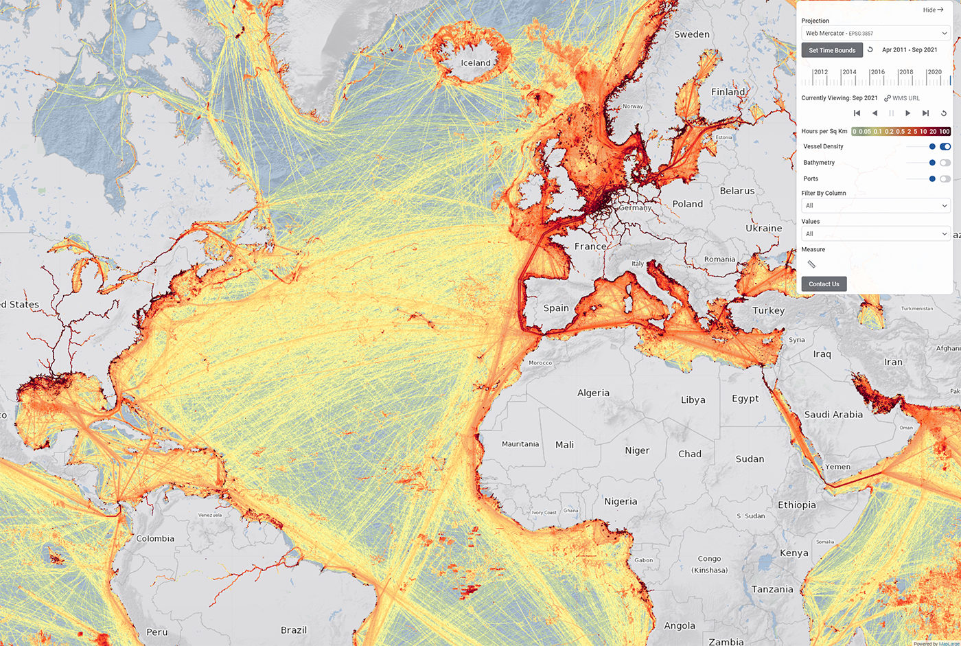
 Global Maritime Traffic Density Service (GMTDS) is a global Standard Nautical Product provided by the National Geospatial-Intelligence Agency (NGA) to enhance Maritime Safety. MapLarge developed GMTDS to collect and apply advanced analytics to hundreds of billions of AIS messages data from multiple sources. GMTDS provides a holistic picture of global maritime traffic densities over time.
- Hydrographic product prioritization
- Revising outdated charts
- Critical navigation safety analysis
- Fishing activity monitoring
- Port activity monitoring
- Environmental and Economic activity monitoring
GMTDS Methodology and Output
GMTDS adapts methods developed by the European Marine Observation and Data Network (EMODnet) to cleanse and aggregate raw AIS messages into a series of monthly vessel traffic density rasters spanning the entire globe.
The primary GMTDS data products are maritime traffic density rasters. GMTDS cleans and enriches raw AIS messages from individual vessels and aggregates the location data into 1 km2 grid cells, displaying the cumulative time spent in each grid cell for all vessels in a given month. This time-density data is updated monthly and available historically for over 10 years. The GMTDS application provides access to explore the data. WMS services and downloads are available by request.